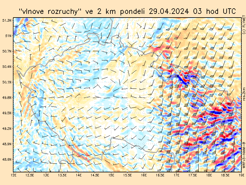
At "top menu" is new GFS. There are pictures from GFS modell with resolution 0.5° for next 7 days. (currently added only in Czech language version)
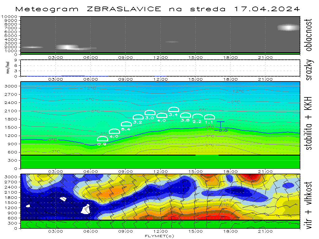
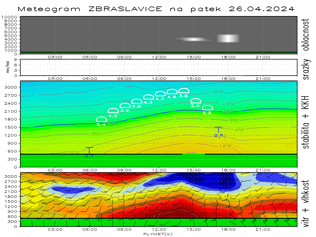
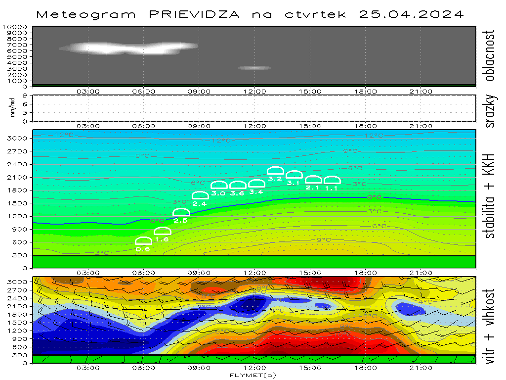
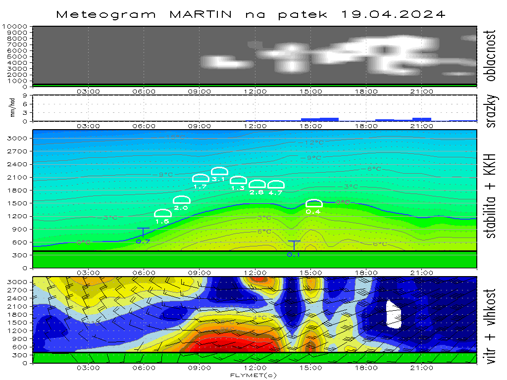
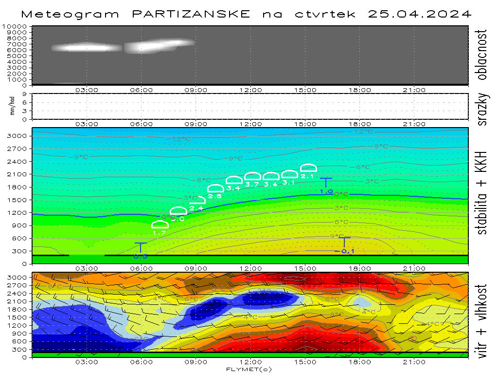
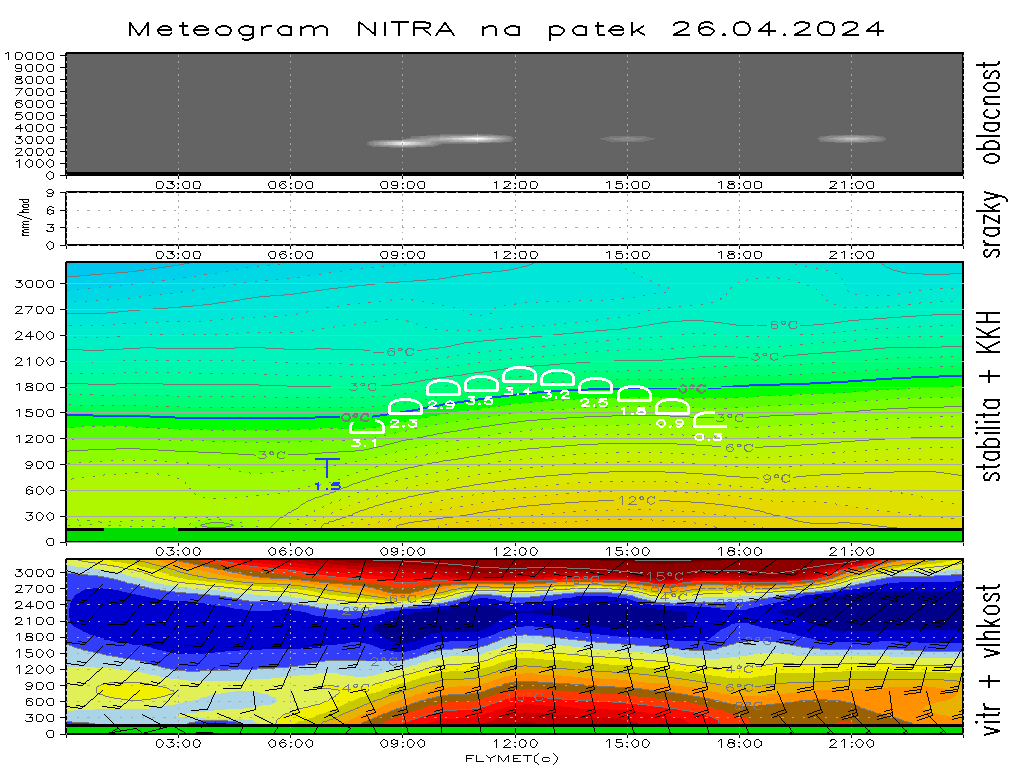
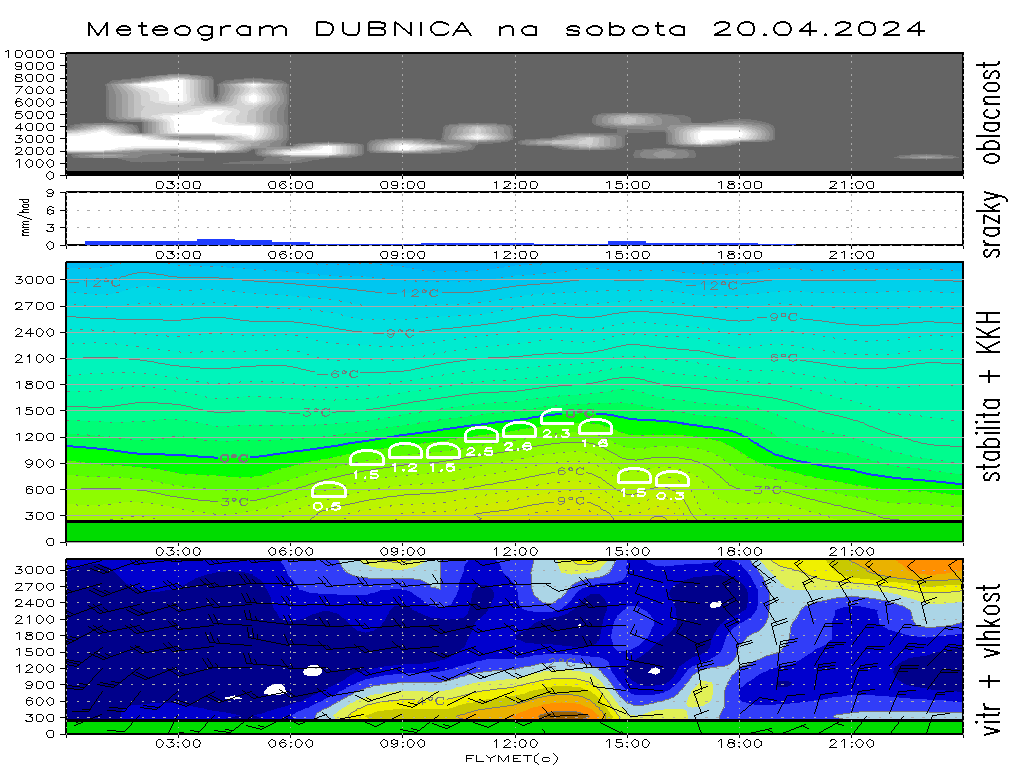
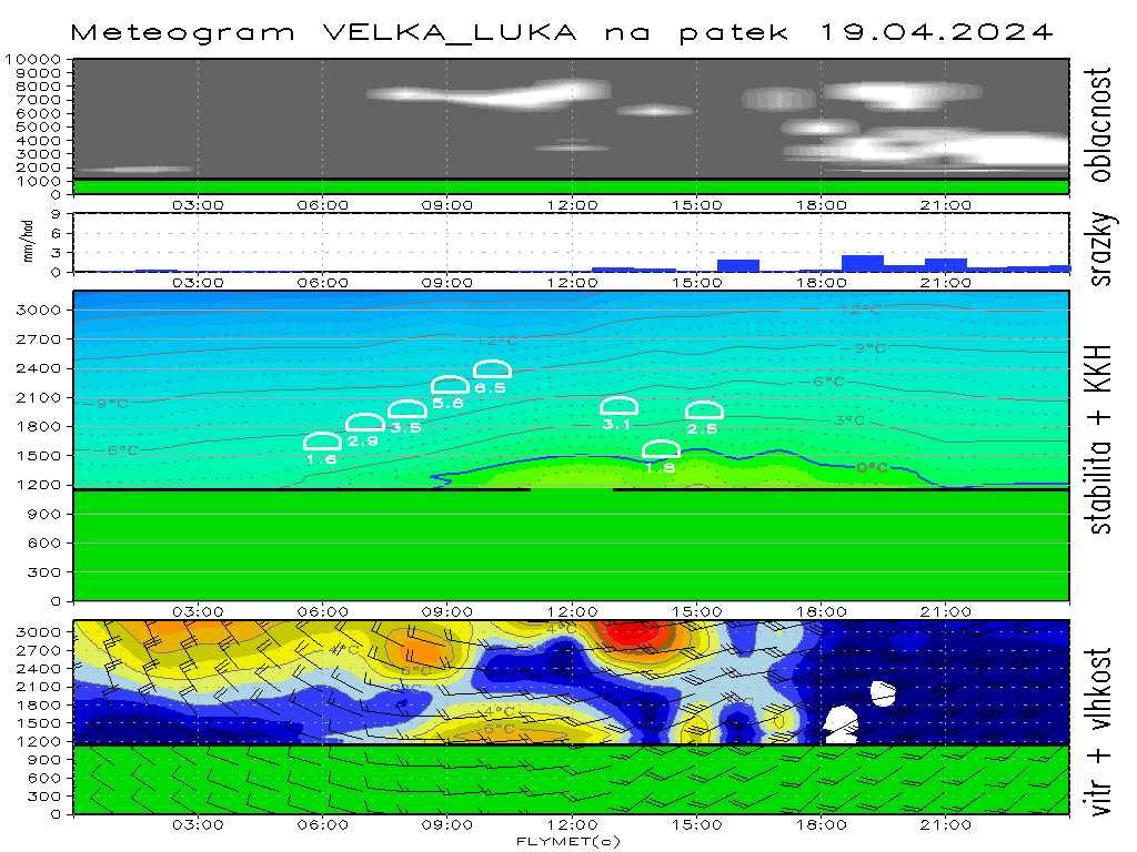
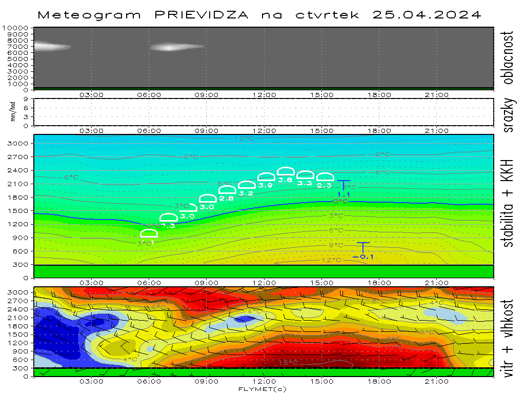
For new season there are new meteograms with hourly analyzed soundage (from 06:00 till 18:00 UTC). I am still working on it, and then view of meteogram may change a little bit...
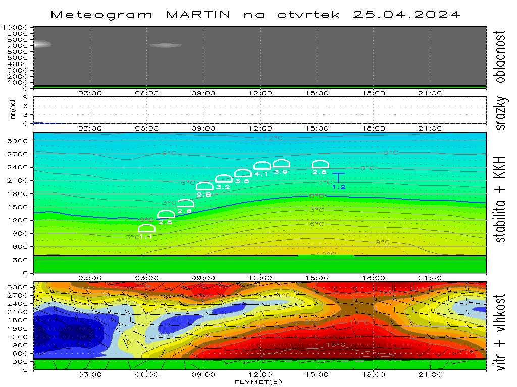
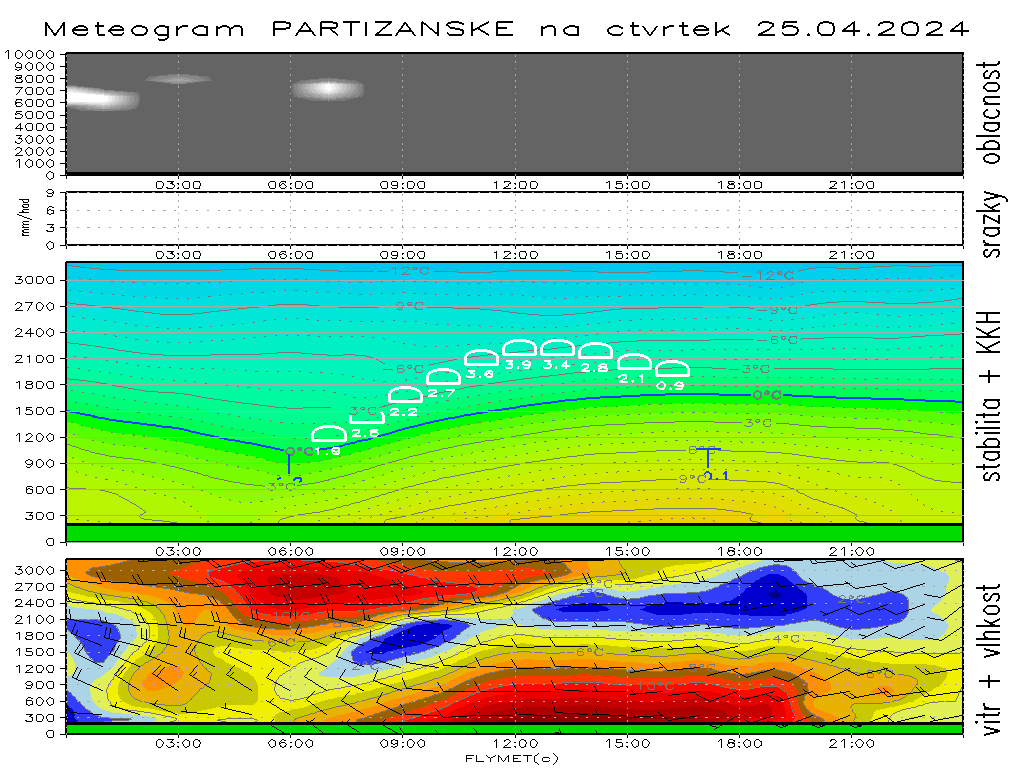
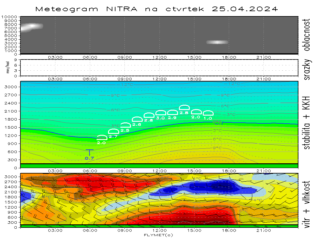
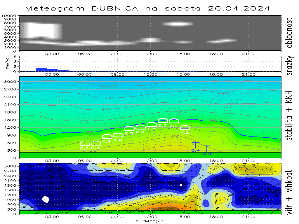
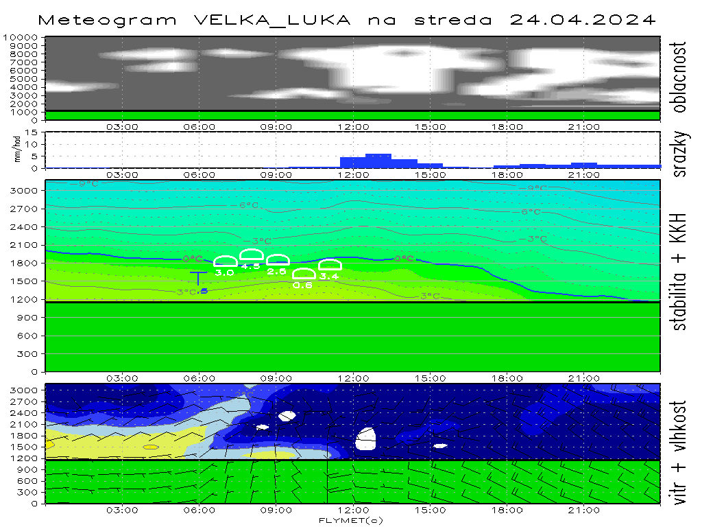
At top of meteogram there are 3D clouds from surface till cca 11 km. There may appear precipitations at this part of meteogram.
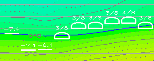
At middle part there are temperature "sounding", highlited is 0°C level. White line is height of CCL, when convective temperature are achieved then cumulus are drawn. Over this cumulus is drawn quantity of cumulus clouds in octas. When no cumulus clouds are drawn there is written deficit of convective temperature instead octas. From surface till cca FL100.
At bottom part of meteogram there id shaded difference between temperature and dew point temperature (dew point deficit) and wind barbs. from surface till cca FL100.


